Transat bakerly - course and weather
With the demise of The Challenge, The Transat bakerly remains one of the few major offshore events in the calendar that doesn’t go ‘the pretty way’ weather-wise. While competitors in top French events such as the Transat Jacques Vabre and Route du Rhum, leave north France in the autumn and can expect to encounter two or three, often very severe, weather features before they are south enough to hook into the northeasterly trades, in The Transat bakerly, competitors not only have to sail in the opposition direction of travel of the prevailing weather systems thundering eastwards, but by having a destination that is further north than the Caribbean/Brazil/central America of the French races, pass closer to the centres of the North Atlantic depressions.
The net result is that in The Transat bakerly competitors not only get to see ‘more weather’, negotiating a new major meteorological feature pretty much every other day, but these are likely to be more extreme than they would be further south.
As they approach the New World, competitors have the added challenge of the Gulf Stream that can run at up to 3 knots and is, again, opposing them. Then there is the warm Gulf Stream colliding with the freezing Labrador Current that has flowed down from the Arctic and the fog caused by the two meeting. With all this to contend with, it doesn't take a rocket scientistic to see why meteorology and routing are perhaps more vital elements of this rather than any other offshore race.
In the Transat bakerly, the solo skippers are permitted to work with shore-based routers during the race in both the multihull classes, the Ultimes and Multi 50s, for reasons of safety. But routing is strictly prohibited in the mono fleets, the IMOCA 60s and Class40s, where skippers must download their own weather information on board and use routing software such as Expedition or Adrena to develop their own strategy (while at the same time as no doubt being deeply sleep deprived).
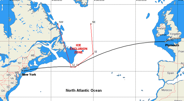
The great circle from Plymouth to New York passes through southeast Newfoundland and Nova scotia, so, avoiding land such, the minimum distance skippers in the first OSTAR back in 1960 (who sailed the same course skippers are this year) could have sailed was around 2940 miles.
This traditional course saw competitors shave Newfoundland before tackling the Grand Banks, the giant shallows stretching some 260 miles south and 220 miles east of Newfoundland where are depth are typically less than 100m. The fog from the Labrador Current and Gulf Stream combining here, typically hides the enormous fishing fleet that regularly resides on the Banks, plus their associated paraphernalia such as nets…
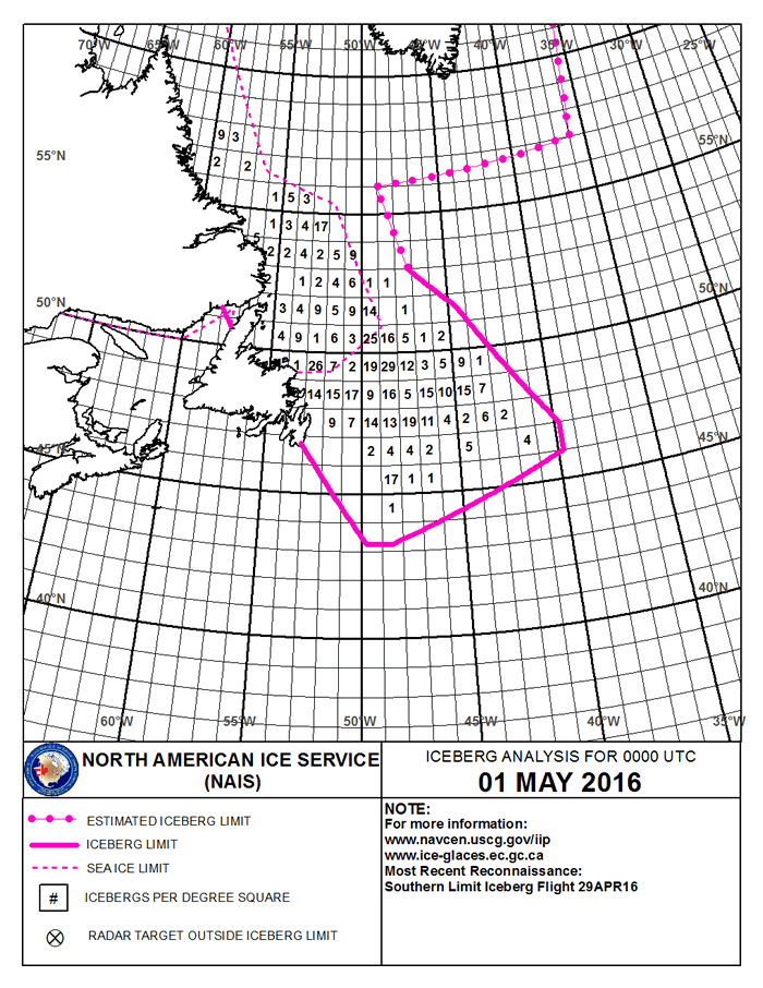
But the real hazard for yachts and ships in this area is the minefield of icebergs. The chart below indicates the number of icebergs spotted per square degree and show them drifting as far south as 43°N and as far east as 40°W. To avoid icebergs Race Director Gilles Chiorri and his team have set up an ice exclusion zone, the southerly limit of which is at 41°30N (between 50°30 and 48°30) while the southeastern corner of the zone is at 40°W. This compares with the ice exclusion zone for last year’s eastbound fully crewed Transatlantic Race which was set at the same latitude but between 51°30 and 48°W.
This is not the only exclusion zone in the race. The Sis also states that competitors are prohibited from entering Traffic Separation Schemes eg Scillies, Fastnet, Casquets, Ouessant, etc and 'Charlie Area' WNW of Nantucket (which is a whale protection area).
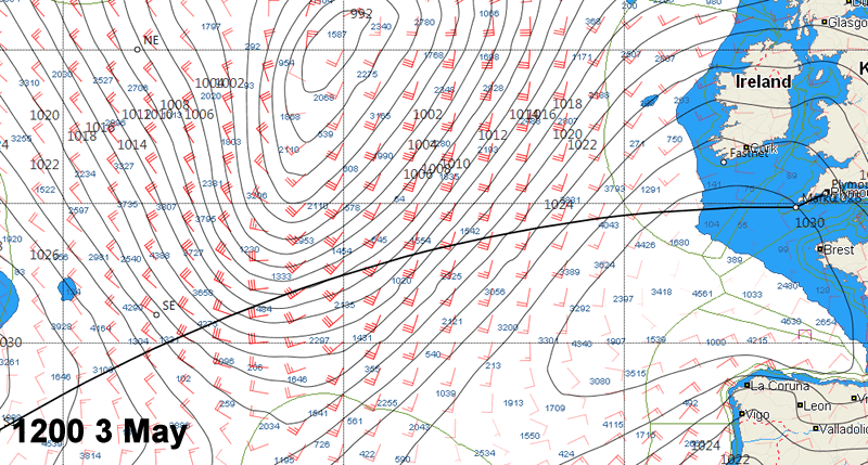
Forecast
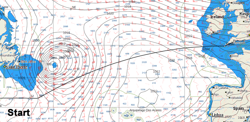
The PredictWind revised GFS model and the Bracknell synoptic chart show that start time tomorrow (1430 BST Monday 2 May) is set to coincide with a significant cold front rolling across Plymouth. Preceding this the southwesterly wind is forecast to be 20 knots gusting 30, dropping to 15-20 after the wind has veered northwest mid-afternoon.
This northwesterly, that will encourage the boats initially to head WSW on starboard tack, is linked to the wind blowing around the northeast side of Azores high. Come Tuesday the high will be mid-way between the Azores and southern Ireland meaning that 24 hours into the race, conditions will become quite benign.
Before then we will get some idea of which competitors will be heading for a 'proper' OSTAR ie heading north into big conditions, and those intending to scamper away to the south for a lighter, longer race.
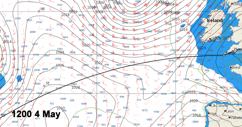
The high is heading northeast, so come Wednesday its centre will be over across the UK. Those competitors heading north will be waiting for the wind to fill in from the southwest so they can tack, while those going south will be looking to reach the favourable northwesterlies off La Coruna.
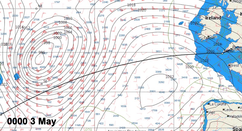
By this stage the fleet will have separated dramatically with the 100ft Ultimes speeding away across the horizon and while the Class40s will be looking at a race some two to three times the duration of that of the long legged multihulls. Race Director Gilles Chiorri has plotted the routing for the Ultimes here.
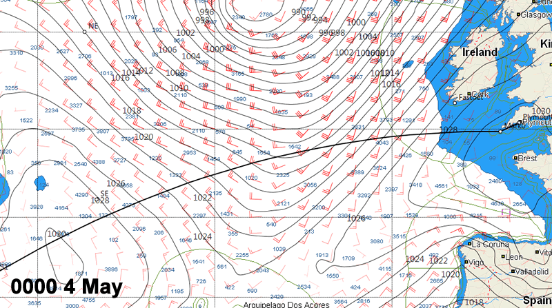
Former Dongfeng Racing skipper Charles Caudrelier, who is working for Seb Josse and the Gitana team, gives his take on the weather: “For some days, the weather models in the North Atlantic seemed to favour a southerlycourse but this morning the situation has changed. There are now several possible courses, including a rather brutal one to the North. The very large exclusion zone, defined by the race organisation to avoid the icebergs off Newfoundland, inevitably has an influence on strategy because the sailors will have to slip under it and it’s already a long way South.
"Today, there are two major lows to be negotiated along the way. The first will roll through on Tuesday and Wednesday and is active and windy with 40 knots forecast, while the second could be negotiated via the north, though that option comes with the risk of getting trapped in the centre in order to get around the exclusion zone. As such, you have to choose between hunting down the strong wind to the north in some really tough conditions or try the south with what will be a complicated route to pull off singlehanded. Today, there’s also an in-between option taking shape, but how will that play out tomorrow? We’ll know more this evening and then it’ll be over to Sébastien to decide.”
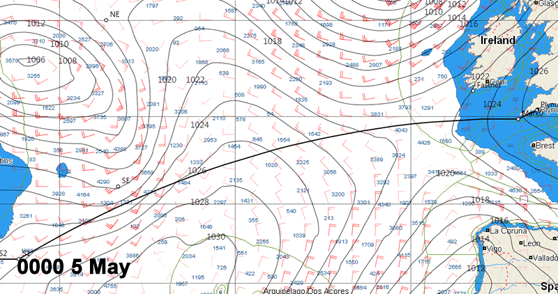
Click on images to enlarge them (Courtesy of Expedition and PredictWind)


Businesses

Pro businesses
-
Italy
-
United Kingdom
-
-
Editor's choice
Member blogs
-
 Ned Collier Wakefield: MOD70 round BarbadosWell that was intense. 12 hard fought for seconds for the win. In idyllic conditions, Tony Lawsons MOD ...
 -
 Mini Transat leg 2 reportThe second leg of the Mini Transat started on 31st October, just over a month after ...
 -
Leg 1 reportI’ve been working towards the Mini Transat now for three years. In 2013 I was part ...
Business blogs
-
 The Island Sailing Club in Cowes, Isle of Wight, is delighted that Prince Michael of Kent ...
 -
Peta Stuart-Hunt chats with the 25 year-old British solo sailor Lizzy Foreman before she sets sail ...
-
The 2015 Student Yachting World Cup (SYWoC), an ISAF-recognised event hosted and run by students for ...
Editor's Choice
-
 Three legs down into Ian Walker’s
 -
 Winning all but two races at
 -
 For the first time in its
Latest Comments
Add a comment - Members log in