Sea breeze city
Friday April 27th 2007, Author: James Boyd, Location: United Kingdom
"It's not normally like this" is a phrase we hear regularly when attending windless/gale bound/torrential rain ridden regattas about the globe.
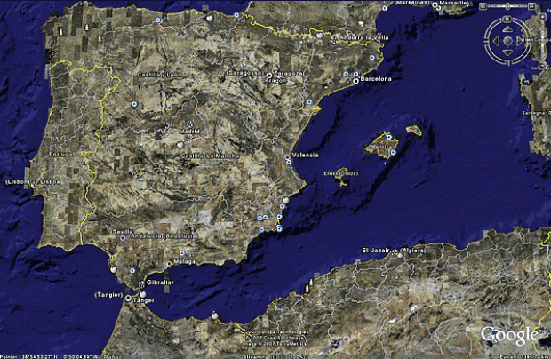
The light winds that caused seven days of racing to be cancelled at the beginning of the Louis Vuitton Cup's Round Robin 1 are an unfortunate and extreme case of this, caused, we are told, by a meteorological 'block', where the typical weather systems in our part of the northern hemisphere invert - ie a high pressure system over northern Europe bringing July-like conditions to the UK and torrential rain to North Africa, with little Valencia caught in between (see below).

At a presentation earlier in the week, provided kindly but perhaps slightly oddly by Alinghi (rather than ACM or one of the challengers), we were shown just how unusual this meteological phenomenon was as the charts immediately below shows. These figures are based on the hours of 12-1500 for winds of of 7-23 knots, typically the range in which sailing can take place, and show that in April 2007 only 50% of days have been sailable compared to on average around 85% for previous years, with seven consecutive sailing cancelled compared to the typical mean of around two.
Interestingly, using the same criteria, it compares with 35-55% of days that can be sailed during the summer months in Auckland.


A block is effectively a meteorological brick wall that spans the atmosphere from ground level up to around 10km (ie most of it). We are told it is not uncommon particularly over Europe, but what is unusual this April has been that the block has lasted for more than a month. Absolutely this has nothing to do with global warming, or nothing provable at least, oh no.
Given that a low pressure system is now over mainland Spain and heading gradually in the direction of Valencia, would suggest that the block is in the process of dissipating and we may shortly be back to normal.
Ignoring the present scenario, Valencia is normally is sea breeze city, the scenario we expect to see increasingly over the next week as summer arrives, temperatures rise and the difference in temperature between the land and sea increases enhancing the thermal afternoon breeze.
As the America's Cup defender and therefore ultimately the people who picked Valencia as the venue for the 32nd America's Cup, Alinghi know more about the weather here than anyone and at the heart of John Bilger's met team within the Swiss challenge resides numerical meteorologist Jack Katzfey, who provided us with a quick meteorological guide to Valencia.

Firstly the topography....
Valencia lies on the Mediterranean coast of Spain in an 80 mile wide bay facing east directly towards Palma some 140 miles away. To the north of the bay is the former TP 52 venue Castellon and to the south is the prominent headland, Cap de la Nau, just south of Denia, before the coast turns sharply southwest towards Alicante.
While Valencia seems very flat, it is actually part of a river valley (hence the flat bit running through the middle of town where all the futuristic new buildings are) and is encircled by a mountain range around 15 miles to the south, 10 miles to the west, the closest mountains being to the NNW, where they almost reach the sea.
It is thanks to this mountain range that the wind is rarely from the westerly quadrant.
The sea breezes
Statistically, according to Katzfey, during the summer months in Valencia you get the sea breeze 90% of the time while the other 10% it is usually from the west.
The situation over Spain, reasonably typical of north Mediterranean countries, as Katzfey explains: "In the summer time because we are generally under a high pressure area and there are not many synoptic systems, what happens is that all along the coast of Spain there tends to be a sea breeze due to the low pressure over the Iberian peninsula - because it is very high, with the mountains and higher elevations that helps to suck the air in from the coast. Then you get local things like mountains enhancing the sea breeze here in Valencia."
However off Valencia, there are in general three different sea breezes:
northeasterly - is more of a gradient breeze, coming with the northeast wind. This is the wind that has been blowing for the last few weeks and is associated with the gradient breeze. "However," states Katzfey, "it wasn’t strong enough to bring the wind on the water, so we didn’t get a sea breeze. The sea breeze can’t develop with the NE gradient very easily. So either the wind has to be strong enough to be on the water to get a good breeze or you’re not going to get a good breeze at all."
easterly - is more of a local sea breeze. "It tends to be weaker, more fluctuating, it is probably the most difficult one to predict and hardest to understand."
southeasterly - this tends to be the strongest sea breeze, which can reach 15+ knots. Part of the reason this breeze is stronger is that it is accelerated up the coast by the mountain range to the south of the Bay of Valencia. "The wind builds further south then comes up, so we’re at the sort of tail end of the breeze from the south." This breeze tends to tail off the further north it travels which is the principle reason why on Wednesday there was substantially more wind on the south course than there was on the north.
Obviously the formation and direction of the sea breeze are heavily dependent upon what is happening with the overlying gradient wind. If, for example, a depression is moving across to the north then there is every possibility of westerlies. Obviously this is an offshore breeze and as a result is a lot more shifty ("short period fluctuations" as Katzfey refers to them) than the sea breeze.
What is odd about the westerly breeze here is that thanks to the topography inland it tends to only be westerly, the wind flowing across the city from the two river valleys that lead into Valencia one just south of west, the other just north of it. "It tends to be due west coming out on to the water and really there is very little between there and northeast and there and the southeast, although sometimes you get the wind swinging around." So in short typically the wind either blows from the west or anywhere within a 90deg arc between southeast and northeast.
As ever of course the characteristics of the westerly gradient breeze and the sea breeze are different. While the westerly offshore breeze is more stable in direction it has shorter shifts and is more gusty, while the sea breeze can trend more slowly in different directions. "The direction can change 5, 10, 15 degrees in the afternoon and there is no obviously forcing of what is causing those changes," says Katzfey of the sea breeze. "When it is going to happen is the key thing. Sometime you know it is going to happen but when it is going to happen is always very difficult." This is the race winning data.
Of course there are a legion of other scenarios, one of the most interesting being if there is a westerly gradient breeze as a southeasterly sea breeze is trying to form. "Sometimes there is a battle between the two of them," says Katzfey. "The sea breeze will start forming and try to come charging up here and the westerly is trying to still come up and sometimes you get a very sharp demarcation between them from where it goes from westerly at 15 knots to, bang, southeasterly at 15 knots in a very short period of time. It is amazing because there are no clouds or anything, although you can see it on the water. It is it is also very tricky because sometimes it comes in and sometimes it stays offshore. It is not that predictable unfortunately."

This is one of the reasons conditions tend to be different on the north and south race courses. On average there is 1-2 knots more on the south course thanks to the stronger southeasterly.
Obviously conditions change throughout the day. When the thermal breeze starts to shut down fully, the wind typically shifts to the northeast, but even this doesn't always happen. "Nothing always happens with weather!" says Katzfey, succinctly summarising his profession.
Tools
For this America's Cup, ACM elected to install the Meteologicial Data Service, a network of weather buoys laid out over the race areas and beyond. Data from this has been collated since it was installed in 2005 and this information has been available to all the teams. This has been fantastic for all the campaigns as now they can collection data from the race course while racing is happening. Although they are not allowed the buoy data on board when they are racing, teams can go back to their bases post-racing and see 'ah, yes there was more pressure/shift on the left hand side'.
"In Auckland we all had weather boats and they all put them in the same place, but they couldn’t be on the race course during the race, so during the race you never knew what was really going on," says Katzfey. "Especially trying to get these small changes in wind direction it is really useful to have that data out there and see that data to work out what is going on. So all teams have that and it does help the small teams what wouldn’t be able to have a weather program."
While a lot more meteorological information is available to the teams as a result of this, Alinghi are obviously still trying to have the edge. As we wind up our interview Katzley points over the balcony of Alinghi's well appointed HQ at a vessel tied up at the dock - a 30-40ishft motor boat, standard except that has an enormous mast sticking through its roof up to the same height as a Cup boat rig heeled, we are told. Up and down this mast there are spreaders each fitted with an anemometer used to measure and record data for wind sheer and Katzfey has been trundling around the race area with his team in this, recording data by the gigabyte for two years now...
Most Read
Most Commented
Comments
Businesses
Pro businesses
-
Netherlands
-
France
-
United Kingdom
-
United Kingdom
Editor's choice
Member blogs
-
 Ned Collier Wakefield: MOD70 round BarbadosWell that was intense. 12 hard fought for seconds for the win. In idyllic conditions, Tony Lawsons MOD ...
 -
 Mini Transat leg 2 reportThe second leg of the Mini Transat started on 31st October, just over a month after ...
 -
Leg 1 reportI’ve been working towards the Mini Transat now for three years. In 2013 I was part ...
Business blogs
-
 The Island Sailing Club in Cowes, Isle of Wight, is delighted that Prince Michael of Kent ...
 -
Peta Stuart-Hunt chats with the 25 year-old British solo sailor Lizzy Foreman before she sets sail ...
-
The 2015 Student Yachting World Cup (SYWoC), an ISAF-recognised event hosted and run by students for ...
Editor's Choice
All time favourites...
-
 Three legs down into Ian Walker’s
 -
 Winning all but two races at
 -
 For the first time in its
Latest Comments
Add a comment - Members log in